



Mehr zum Buch
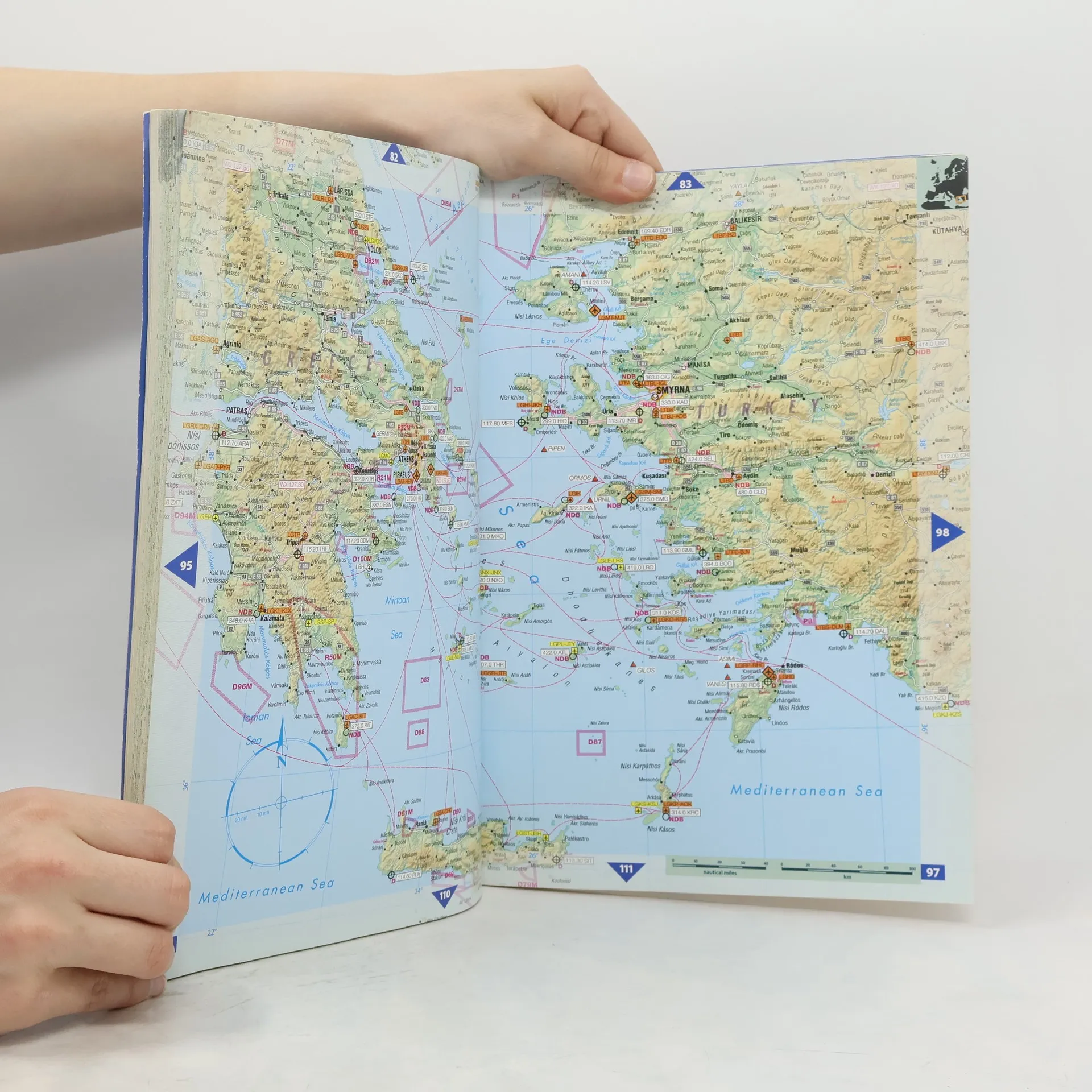
The first atlas designed for pilots that allows you to see immediately where you are in relation to the airways structure, airports, and objects on the ground. It covers Europe, S.E. Asia, and the Middle East. JNC scale, topographical charts are used showing over 4,500 airports. Waypoints, VOR/DME, NDBs, and special use airspace are included, plus weather frequencies, points of interest, landmarks, airport directory with ICAO codes, railways, rivers, and major highways. Airports are color-coded by runway length and surface. International and regional aerodromes are coded by symbol shape. Pilots now have the ability to point out objects on the ground or know immediately where they are in relation to surrounding airports or points from an all-in-one source of information for pre-flight or during flight.
Buchkauf
The pilots Free-Flight-Atlas,
- Sprache

- Erscheinungsdatum
- 1999
Keiner hat bisher bewertet.
- Titel
- The pilots Free-Flight-Atlas
- Sprache
- Englisch
- Autor*innen
- Erscheinungsdatum
- 1999
- ISBN10
- 3000036482
- ISBN13
- 9783000036484
- Reihe
- Kategorien
- Schlagwörter
- Beschreibung
- The first atlas designed for pilots that allows you to see immediately where you are in relation to the airways structure, airports, and objects on the ground. It covers Europe, S.E. Asia, and the Middle East. JNC scale, topographical charts are used showing over 4,500 airports. Waypoints, VOR/DME, NDBs, and special use airspace are included, plus weather frequencies, points of interest, landmarks, airport directory with ICAO codes, railways, rivers, and major highways. Airports are color-coded by runway length and surface. International and regional aerodromes are coded by symbol shape. Pilots now have the ability to point out objects on the ground or know immediately where they are in relation to surrounding airports or points from an all-in-one source of information for pre-flight or during flight.