


Mehr zum Buch
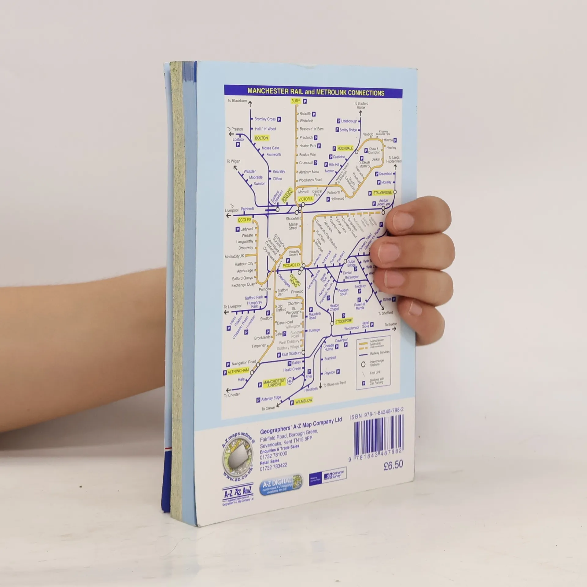
This A-Z map of Manchester includes coverage of:•Manchester•Altrincham•Ashton-under-Lyne•Bolton•Bury•Oldham•Rochdale•Salford•StockportThe paperback book includes 162 pages of continuous street mapping extending to include coverage of:•Cheadle•Heywood•Hyde•Irlam•Manchester Airport•Poynton•Prestwich•Radcliffe•Ramsbottom•Stalybridge•Swinton•Urmston•WilmslowThere are also large scale city and town centre maps of Manchester, Altrincham, Ashton-under-Lyne, Bolton, Bury, Oldham, Rochdale and Stockport and a postcode map.Postcode districts, one-way streets, safety camera locations with speed limits and National Park boundaries are also featured on the mapping.The index section lists streets; selected flats, walkways and places of interest; place and area names; National Rail and Metrolink stations. There is a separate list of hospitals, hospices and NHS Walk-in Centres covered by the atlas.An easy to follow map of the Manchester Metrolink is featured on the back cover.
Buchkauf
Manchester Street Atlas, Autorenkollektiv
- Sprache

- Erscheinungsdatum
- 2011
- product-detail.submit-box.info.binding
- (Paperback)
Hier könnte deine Bewertung stehen.
- Titel
- Manchester Street Atlas
- Sprache
- Englisch
- Autor*innen
- Autorenkollektiv
- Erscheinungsdatum
- 2011
- Einband
- Paperback
- Seitenzahl
- 384
- ISBN10
- 1843487985
- ISBN13
- 9781843487982
- Reihe
- Schlagwörter
- Sachbücher, Karten & Reisen, Reisen
- Bewertung
- 5 von 5 Sternen
- Beschreibung
- This A-Z map of Manchester includes coverage of:•Manchester•Altrincham•Ashton-under-Lyne•Bolton•Bury•Oldham•Rochdale•Salford•StockportThe paperback book includes 162 pages of continuous street mapping extending to include coverage of:•Cheadle•Heywood•Hyde•Irlam•Manchester Airport•Poynton•Prestwich•Radcliffe•Ramsbottom•Stalybridge•Swinton•Urmston•WilmslowThere are also large scale city and town centre maps of Manchester, Altrincham, Ashton-under-Lyne, Bolton, Bury, Oldham, Rochdale and Stockport and a postcode map.Postcode districts, one-way streets, safety camera locations with speed limits and National Park boundaries are also featured on the mapping.The index section lists streets; selected flats, walkways and places of interest; place and area names; National Rail and Metrolink stations. There is a separate list of hospitals, hospices and NHS Walk-in Centres covered by the atlas.An easy to follow map of the Manchester Metrolink is featured on the back cover.